Monitoring Remnants of Fred
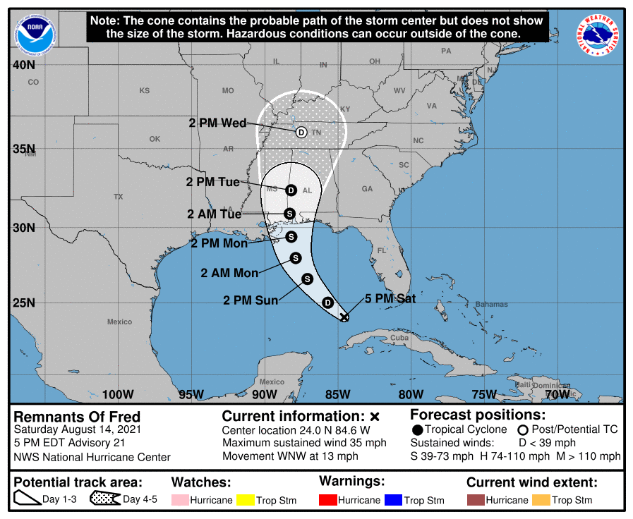
The New Orleans Office of Homeland Security and Emergency Preparedness is continuing to monitor the tropical system, Fred, which has weakened into a tropical wave. Fred is forecast to strengthen back into a tropical depression on Sunday and the most recent models now include parts of New Orleans East inside the cone, with a 10 to 20 % chance of tropical storm force winds in Irish Bayou, Lake Catherine, and Venetian Isles on Monday.
We encourage New Orleans residents to pay attention in the next few days should there be any further westward movement of Fred indicating more impacts to our area. Additionally, the City is monitoring a second system, Grace, which is modeled to enter the Gulf later in the week.
As always, this is a reminder that we are entering the peak of what is predicted to be an above average hurricane season. Please take time now to ensure you and your loved ones are prepared with the following tips:
Hurricane Season Preparedness Tips
-
-
-
-
-